


Location
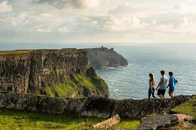
Walk to the highest point of the Cliffs of Moher standing 214m (702 feet) above sea level, where views of the Dingle Peninsula and Loop Head in the South, the Aran Islands to the West with the Twelve Pins and mountains of Connemara to the North can be seen on a clear day. From O’ Brien’s Tower witness the amazing vistas of lush green grass, rocky cliffs and varying shades of sea and sky and hear the waves of the mighty Atlantic ocean crashing below.
The walk takes approximately 3.5 hours from the village of Doolin along a gravel path and finishes at the Cliffs of Moher Visitor Centre. The trail is an easy walk, it requires a basic level of fitness and a good head for heights and is 8km long.
A taxi ride back after the walk from the Cliffs of Moher visitor centre to Doolin village is included in the ticket price. This will be organised for you after the walk.
What's included?
- Guided 8km walk along Cliffs of Moher by local farmer
- Taxi ride back after the walk from the Cliffs of Moher visitor centre to Doolin village
Exclusions
- Tip or gratuity
Please Note
- Public transportation nearby
- Please note: The walk takes approximately 3 hours along a gravel path and finishes at the Cliffs of Moher Visitor Centre where a taxi ride back after the walk from the Cliffs of Moher visitor centre to Doolin village is included
- The trail is an easy walk, it requires a basic level of fitness and a good head for heights and is 8km long.
- Not wheelchair accessible
- Not stroller accessible
- Not suitable for pets
What do I need to bring?
Please bring suitable walking boots, warm, layered, wind and rainproof gear as weather can be changeable.
Meeting Points
Cancellation Policy
Please contact WorldGift for more information.


Validate your login
Sign In
Create New Account